McCleverty reserves 1847 @ wiremutaone
A DigitalNZ Story by Ann Reweti
McCleverty's reserves of 1847 underlay the history of Wiremutaone / Kinapora sections 7, 8, 9 and their links to Te Aro Pā and Pipitea Pā
William McCleverty, Ngauranga, Te Aro Pā, Pipitea Pā, Kinapora, Wiremutaone, Hemi Parai, Ropiha Moturoa
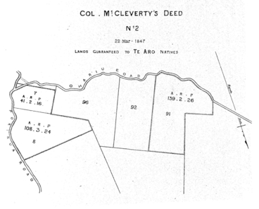
McCleverty awards : sections in vicinity of Ngauranga, ( Sections 6, 7, 8, 9, 10) and Wiremutaone : Te Aro Deed no. 2 Plan (describes part of the Native Reserve 7 and the whole of 8 Kinapora District, also Native Reserve No. 91 in the Ohariu District to the North of which is Unsurveyed Land, the whole containing 290a. Or. 26p.
Wellington District — [Col. Mccleverty's Deed] — 4 Octr 1847
Victoria University of Wellington
Col. Mccleverty's Deed — No 2 — 22 Mar- 1847 — Lands Guaranteed to Te Aro Natives
Victoria University of Wellington
William McCleverty as artist
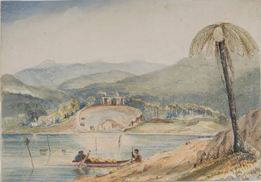
[McCleverty, William Anson], 1806-1897. Attributed works :Lake Wairarapa. [ca 1850].
Alexander Turnbull Library
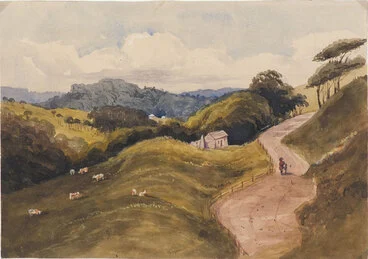
[McCleverty, William Anson] 1806?-1897 :[Silverstream near Wellington. ca 1850?]
Alexander Turnbull Library
Horokiwi Valley near Wellington [picture] /
National Library of Australia
Kapiti, New Zealand [picture] /
National Library of Australia
Leigh's Stockade near Kuripuni River, Porirua Road, Decr. 1847 [picture] /
National Library of Australia
Pawatanui, Rangihaiataís pah in 1846. 1849.
University of Otago
Te Aro Pā: Ngati Haumia was awarded compensatory reserves at Kinapora / Wiremutaone, sections Part 7 and whole of 8 (- most of the land lying between Raroa and Johnsonville Station)
Te Aro Pā, Wellington
MTG Hawke's Bay
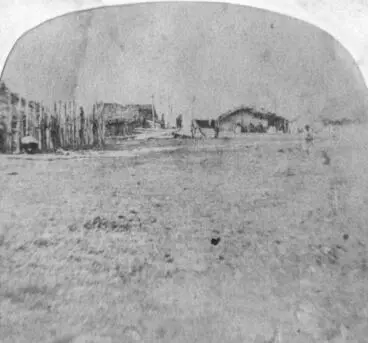
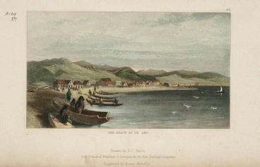
Whata Te Aro pa, Port Nicholson [picture] /
National Library of Australia
Painting of Te Aro pa, 1847
Manatū Taonga, the Ministry for Culture and Heritage
Photographer unknown :Te Aro Flat, Wellington
Alexander Turnbull Library
Wellington city
Alexander Turnbull Library
Te Aro, Wellington
Alexander Turnbull Library
Te Aro Park
Manatū Taonga, the Ministry for Culture and Heritage
Richards, E S (Wellington) fl 1862-1873 :Portrait of Mohi Ngaponga
Alexander Turnbull Library
Ngaponga family grave, plot 53.A, Sydney Street Cemetery.
Alexander Turnbull Library
Hemi Parai
Alexander Turnbull Library
The Simeon family grave, plot 167.P, Sydney Street Cemetery.
Alexander Turnbull Library
Trooper William Wallace
Alexander Turnbull Library
King, Horatio Nelson, 1830-1895 :Colonel Charles Blewitt, 65th Regiment
Alexander Turnbull Library
Captain C. Blewitt, 65th regiment
Museum of New Zealand Te Papa Tongarewa
The late Mr. L. Durling. (Evening Post, 13 February 1939)
National Library of New Zealand
Mr. and Mrs. W. Bramley, of Johnsonville, who recently celebrated their golden wedding. (Evening Post, 27 September 1937)
National Library of New Zealand
Aylmer Courtnay Kenny
Manatū Taonga, the Ministry for Culture and Heritage
As Ngati Mutunga departed for Wharekauri from Matiu, Patukawenga handed Ngauranga to his whanaunga of Te Atiawa: Rawiri Matangi, Manihera Te Toru, Hirini Nukutaia, and Pipitea to Ropiha Moturoa, Wi Kingi Wairarapa (and his own son Ngake).
Pearse, John, 1808-1882 :Nga Hauranga. Residence of the Chief E'Tako. [Between 1852 and 1856]
Alexander Turnbull Library
Rollason, James Bernard Richard Walter, 1856-1906: [Ngauranga, late 1840s]. [ca 1900]
Alexander Turnbull Library
[Barraud, Charles Decimus], 1822-1897 :Ngahauranga Road. [1800s]
Alexander Turnbull Library
McCleverty reserves awarded in 1847 for Te Atiawa at Pipitea Pā
No. 2. Part of the Town Belt bounded on the West by the Kai Warra Warra District, on the South West by section 30 Karori District, on the North by the Town Belt, and on the East by the Karori Road and Town section containing 80 acres.
3. Part of Kaiwharawhara Block. [134 acres.]No. 3. Part 500 acres block on the Western side of the Kai Warra Warra River bounded on the West by the part which belongs to Te Ringa Kuri and on the North by another portion belonging to Ohariu Natives the part given to the Pipitea Natives contains about one hundred and thirty-four-acres.
4. Sections on Porirua Road. [221 acres.]No. 4. A Block of Land on the Porirua Road comprising part of No. 7, and the whole of No. 9, Native Reserves in the Kinapora District containing in all two hundred and twenty-one acres bounded on the West by the Karori Road for fifty chains more or less, on the North by No. 10, section for fifty-eight chains more or less, on the South by No. 6 section for forty five chains and on the East by sections 9 . 10 . 11 . 12 . Harbour District for the distance of seventy-one and a half chains.
In those early days, the main route to Porirua was a track winding up Kaiwharawhara Valley, along the tops of the hills to Johnson's clearing and then down among the thick bush to Tawa.
The land at the top of Ngauranga Gorge was settled first by Frank Johnson, who migrated on the ship Adelaide. He set about clearing and cultivating "Johnson's clearing" in the early 1840s but the McCleverty Reserves lying between Raroa and Johnsonville Station were not settled by Te Aro's Ngāti Haumia until late 1890s.
IN THE EARLY DAYS (Evening Post, 10 November 1916)
National Library of New Zealand
HISTORY OF EARLY JOHNSONVILLE. (Evening Post, 08 November 1916)
National Library of New Zealand
Johnsonville
Manatū Taonga, the Ministry for Culture and Heritage
Saleyards, and state houses, Johsonville, Wellington
Alexander Turnbull Library
Johnsonville, Wellington
Alexander Turnbull Library
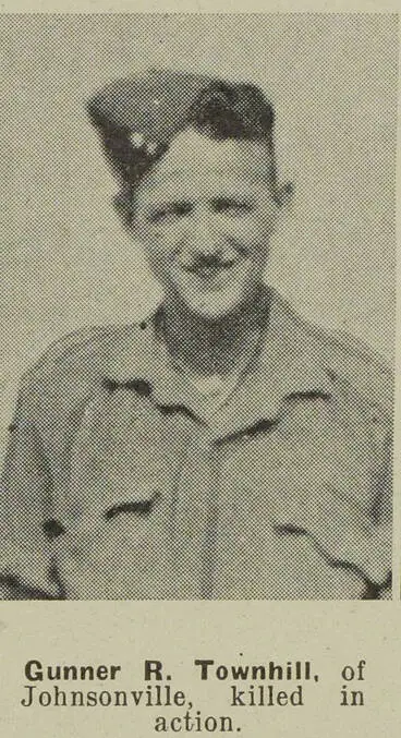
Gunner R. Townhill, of Johnsonville, killed in action
Auckland Libraries
CORONATION DANCE (Evening Post, 21 December 1936)
National Library of New Zealand
ALLEGED MURDER (Evening Post, 26 January 1923)
National Library of New Zealand
LATE CHARLES WALLACE (Evening Post, 03 October 1932)
National Library of New Zealand
LINK WITH THE PAST (Evening Post, 01 October 1932)
National Library of New Zealand
![Wellington District — [Col. Mccleverty's Deed] — 4 Octr 1847 Image: Wellington District — [Col. Mccleverty's Deed] — 4 Octr 1847](https://thumbnailer.digitalnz.org/?resize=770x&src=https%3A%2F%2Fndhadeliver.natlib.govt.nz%2Fwebarchive%2F20201108000000mp_%2Fhttp%3A%2F%2Fnzetc.victoria.ac.nz%2Fetexts%2FTur02Plan%2FTur02PlanP049a.jpg&resize=368%253E)
