Mount Tarawera and the Pink and White Terraces
A DigitalNZ Story by Pearl
The eruption of Mt Tarawera
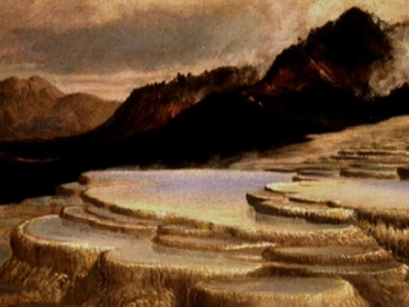
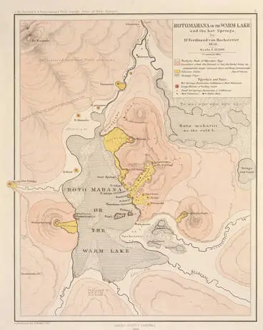
The Pink and White Terraces were a natural wonder of the world. They were located on the shores of Lake Rotomahana in the Tarawera district. Over looking the lake was Mt Tarawera. Mt Tarawera is 1,111m in height and its craters at Rotomahana and Waimangu are still active today. In 1886 the Pink and White Terraces were destroyed when Mt Tarawera violently erupted.
Tarawera
NZ On Screen
Mt Tarawera
Museum of New Zealand Te Papa Tongarewa
Mt Tarawera in eruption, 10 June 1886
Museum of New Zealand Te Papa Tongarewa
The eruption of Mt Tarawera - roadside stories
Manatū Taonga, the Ministry for Culture and Heritage
Shortly after midnight on the morning of the 10th of June 1886, people were awoken by a series of 30 very strong earthquakes. They were felt as far as the shores of Lake Rotorua. That evening there was a violent thunderstorm and soon the skies were filled with lightning and molten lava shooting through the air as the three peaks of Mt Tarawera blew their tops. This eruption has been described as the most deadly eruption since the arrival of Europeans in Aotearoa. The eruption of Mount Tarawera lasted for 6 hours and 120 people were killed. Nearly all that died were Māori. The eruption was so powerful that it was heard as far away as Blenheim. It was even reported to be heard in Auckland.
Sound Archives: the Mt Tarawera Eruption
Radio New Zealand
One of the areas most visited tourist attractions nowadays is the Buried Village. This village was named Te Wairoa and it was buried along with other villages in the area by hot, heavy, ash and mud that came raining down during the eruption. Te Wairoa was a Māori and European settlement that was founded in 1848 by the Reverend Seymour Mills Spencer. Many people stayed in Te Wairoa on the way to visit the famous Pink and White Terraces. The Buried Village is now open to the public and shows the uncovered ruins of that terrible night.
Mt Tarawera and Ruawahia from Te Ariki
Manatū Taonga, the Ministry for Culture and Heritage
Mount Tarawera Eruption : North Island Map
Museum of New Zealand Te Papa Tongarewa


