Navigation: Tuia Mātauranga Curiosity Card
A DigitalNZ Story by National Library Services to Schools
The navigation curiosity card features Ātea a Rangi — a star compass based on traditional Pacific navigation — at Waitangi Regional Park, Napier. Ātea a Rangi features pou (poles) related to the rising and setting points of stars, the sun, and the moon. The image below is a Marshall Islands navigation chart made of sticks tied together. Cowrie shells represented the relative positions of islands.
Replica navigation chart
Manatū Taonga, the Ministry for Culture and Heritage
WHAKATAUKĪ
"Me mātau ki te whetū, i mua i te kōkiri o te haere"
"Before you set forth on a journey, be sure you know the stars"
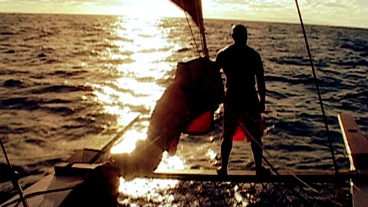
Kupe - Voyaging by the Stars
NZ On Screen
Young waka crew follow stars back to New Zealand
Radio New Zealand
Tagata Pasifika - Hine Moana: A Journey Home
NZ On Screen
Waka Warriors - Full Series
NZ On Screen
Pacific Navigation
DigitalNZ
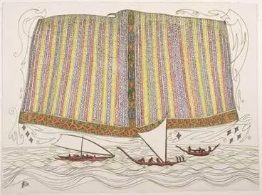
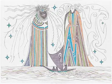
Maui and Mahuika
Auckland Art Gallery Toi o Tāmaki
BACKGROUND
Māori star compass
Te kapehu whetū — the Māori star compass — divides the 360 degrees around a canoe in the open ocean into different whare (houses). The location of these houses depends on where the sun, moon and stars set and rise.
Source: 'Canoe navigation — Ocean voyaging', URL: http://www.teara.govt.nz/en/diagram/2222/maori-star-compass, (Ministry for Culture and Heritage), (published 8-February-2005)
Kāpehu whetū
Ko te mahi a te kāpehu whetū he whakaroherohe i te wāhi taiāwhio i te waka ki ētahi whare. Ka mōhiotia kei hea ngā whare nei mā ngā tohu o te rā, te marama, te kakenga me te toremitanga o ngā whetū. Kātahi ka whakamātau te urungi ki te pupuri i te waka i runga i tētahi huarahi.
Source: 'Te whakatere waka — Te haere i te moana nui', URL: http://www.teara.govt.nz/mi/diagram/2222/kapehu-whetu, (Ministry for Culture and Heritage), (published 8-February-2005)
Canoe navigation
Traditional navigators used the rising and setting points of stars and planets as signposts. During the day, the sun was a guide, and in overcast weather, ocean swells and wind direction were used to chart the way.
Source: 'Canoe navigation', URL: http://www.teara.govt.nz/en/canoe-navigation, (Ministry for Culture and Heritage), (published 8-February-2005)
Te whakatere waka
Ka tohua ngā wāhi e kōhiti ai, e heke ai ngā tūmomo whetū. I te awatea, ko Tama-nui-te-rā te kaitohu i te ara; i te marangai, ko ngā āmai me ngā hau o Tawhirimatea kē.
Source: 'Te whakatere waka', URL: http://www.teara.govt.nz/mi/te-whakatere-waka, (Ministry for Culture and Heritage), (published 8-February-2005)
Early theories
The first explorers had no maps or navigational instruments, and there has been spirited debate among sailors and scholars as to how they settled the region. Early theories ranged from mythical hero navigators who discovered new lands and returned home with sailing directions, to accidental voyagers who drifted away from islands to which they could not return.
Recent understanding
We now know that migrations were deliberate, because they involved taking the people, plants and animals needed to establish sustainable colonies.
Source: 'Pacific migrations', URL: http://www.teara.govt.nz/en/pacific-migrations/page-5, (Ministry for Culture and Heritage), (updated 8-February-2017)
Ngā ariā tōmua
Kāore he mahere whenua, he kāpehu rānei hei awhina i ngā kaihōpara tuatahi ki tēnei pito o te ao. Nā runga i tēnei āhuatanga kua roa te wā e tautohetohe ana te hunga eke moana rātou ko ngā pūkenga mō te āhua o te whakanoho i te rohe nei. Kōrero ai ngā ariā tōmua mō ngā kaumoana rongonui nā rātou ngā whenua hōu i tūhura i mua i tā rātou hokinga ki ngā moutere; me ngā haerenga tūponotanga mai o ērā te hunga i pūhia ō rātou waka kia wehe i ō rātou ake moutere kia tau ki ngā moutere tauhōu, kore mō te hoki.
Ngā ariā o ēnei tau tata
Kei te mōhio tātou ināianei, he mea āta wānanga ēnei heke a rātou mā i te mea, heria mai ai ko ngā tāngata, ngā tipu, ngā kararehe e tupu ai te pā harakeke i roto i ngā whakatupuranga.
Source: Ngā heke i te Wai Nui', URL: http://www.teara.govt.nz/mi/nga-heke-i-te-wai-nui/page-5, (Ministry for Culture and Heritage), (updated 8-February-2017)
Interpretations of Orion
Manatū Taonga, the Ministry for Culture and Heritage
The Pleiades
Manatū Taonga, the Ministry for Culture and Heritage
Kīngitanga flags: Mahuta's flag
Manatū Taonga, the Ministry for Culture and Heritage
compass, marine
Auckland War Memorial Museum Tāmaki Paenga Hira
sextant
Auckland War Memorial Museum Tāmaki Paenga Hira
QUICK FACTS
- The Ātea a Rangi is a tool that has been used to memorise the celestial bodies’ movements and navigate waka across the ocean for thousands of years. It has been passed down from generation to generation since the times of great explorers such as Māui and Kupe.
- The waharoa and pou have been carved from both fallen native logs and from recycled power poles.
- In Māori tradition the family of light are the sun, moon, planets, stars and constellations. Tamanui-te-rā, the sun, was the main god of the heavens. The moon was associated with women and fertility. There are many stories to explain the appearance and movement of the planets and stars. Meteors were thought to be a sign of a future event such as the death of a chief.
- The maramataka is the traditional Māori calendar, based on cycles of the moon. Māori recognised several star patterns and planets, and planted crops by the moon.
- Matariki, or the Māori New Year, commences when the star cluster Pleiades is seen to rise just before dawn in late May or early June.
- The full extent of early Māori astronomical knowledge is not known. It is likely that the Polynesians who journeyed to New Zealand navigated by the stars, but much of that knowledge disappeared when Europeans settled the Pacific.
- The first European astronomers in New Zealand were James Cook and Charles Green.
- In tradition, the ancestors of Māori came to New Zealand from Hawaiki, navigating the seas in their canoes.
Pacific voyaging
Manatū Taonga, the Ministry for Culture and Heritage
Eel [1]. From the installation: Polynesian navigators
Museum of New Zealand Te Papa Tongarewa
'The legend of the voyage to New Zealand'
Manatū Taonga, the Ministry for Culture and Heritage
OTHER RESOURCES
Ātea a Rangi — star compass — He kāpehu whetū i hono ai ki ngā tikanga whakatere waka tūturu o Te Moana-nui-a-Kiwa.
Grand Master Mau Piailug and His Star Compass (Youtube video, 6.45) — Grand Master Navigator Mau Piailug demonstrates his star compass.
Kāpehu whetū — te whakatere waka.
Kāpehu whetū — star compass — navigators who know the direction and position in which the stars rise and set can use the horizon as a compass.
Maramataka — the Māori lunar calendar.
Navigating by the stars — an activity where students learn the cardinal points of the compass.
Navigating with sun, moon and planets — knowledge about the apparent movement of the Sun, Moon and planets across the celestial sphereis important for wayfinding.
Pacific migrations — a map and timeline of early migrations across the Pacific Ocean.
Pacific navigation — resources related to Pacific navigation.
Papa Mau — The Wayfinder — video about the revitalisation of non-instrument navigation.
Project Matauranga — video about traditional navigation.
Revitalising Māori astronomy and navigation — Māori ancestors possessed a wealth of astronomical knowledge that they referred to as tātai arorangi.
Tātai arorangi — i whakamahia e te tohunga, a Mau Piailug he kāpehu whetū pēnei i tēnei.
Tātai arorangi and the wonder of Māori astronomy — Toa Waaka of SMART (Society of Māori Astronomy Research and Traditions) recites and then explains the stars of the Milky Way from a Māori perspective. Audio is in Māori.
Te Whakatere Waka — Ngā heke i Te Moananui-a-Kiwa.
The first astronomers — the Polynesian ancestors of Māori used the stars to navigate the Pacific Ocean on their voyage to New Zealand.
The star compass – kāpehu whetū — stars rise in the eastern horizon and set in the western horizon. Navigators who know the direction and position in which the stars rise, and set can use the horizon as a compass.
The use of stars in navigation — in making long ocean voyages the ancestors of the Māori carried on their vessels one or two expert star-gazers, men versed in the lore of tātai arorangi.
Traditional navigation — traditional Polynesian navigation (also called non-instrument navigation or wayfinding) means finding your way without any of the tools modern navigators use.
Tupaia’s Chart 1769 — ko te whakawhāititanga o ngā mātauranga a ngā tūpuna mō Te Moana Nui a Kiwa. He kore noa iho ki ō te pākeha mahere i aua wā.
FERTILE QUESTIONS
- How has our need and ability to navigate changed over time?
- Inamata, i pēhea tā te Māori whakatere i Te Moana-nui-a-Kiwa?
- What does it mean to find our way? How can we do it?
- What place does traditional knowledge have today?
- He aha e whai take tonu ai te ako i ngā tikanga whakatere waka a ngā tūpuna o te Moana-nui-a-Kiwa?
- What is your question?
The godwits' migration
Radio New Zealand
Whale Navigation
Radio New Zealand
ADDITIONAL QUESTIONS
- What interactions occur between the Earth, Moon, Sun and stars? What results from these interactions?
- How can knowledge of both nature and science be useful?
This story was curated and compiled by Te Puna Mātauranga o Aotearoa | National Library of New Zealand, Services to Schools staff, 2019.


