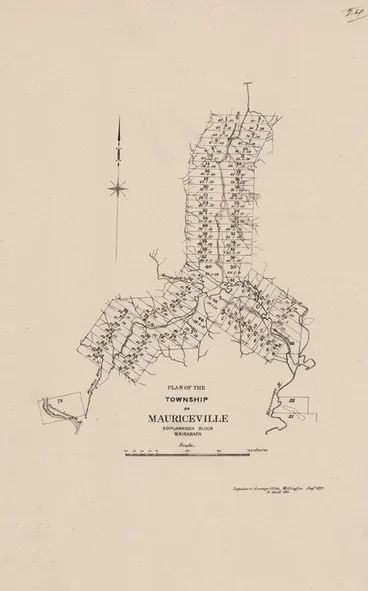
Wellington Land district - 61 Survey Plans (1839-1876)
A DigitalNZ Story by Dawn Chambers
This is based on a listing compiled by Dr Brad Patterson in his 1984 thesis titled "Reading between the lines: People, Politics and the Conduct of Surveys in the Southern North Island, New Zealand 1840-1876."
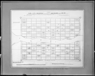
SP 2 (14 Aug 1840)
Wellington Town Sections - shows NZ Company Land Order numbers
National Library of New Zealand
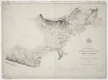
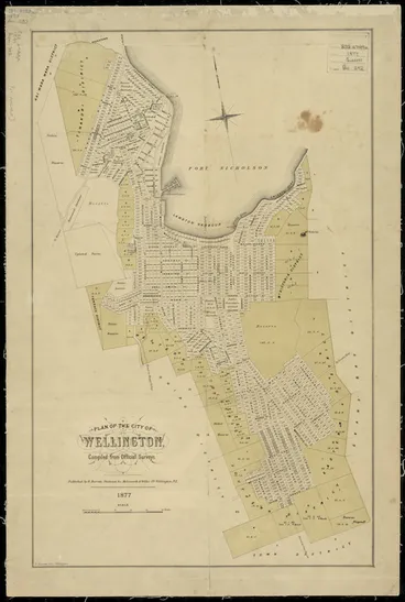
SP 3 (1872)
Shows reclamation abutting the harbour rim and Town Belt encroachment
National Library of New Zealand
SP 4 Wades Town 1842 - Alexander Turnbull Library
SP 5 Plan of the City of [Petre] in the District of Wanganui 1842 by J. Thomas and F. Sheppard - Survey Office Plan SO 10416 Archives NZ Ref: AFIH 22381 W5692/77 Roll Plan 549c (R22549259)
SP 6 Rough Plan of the Town of Petre 1852 by R. Park - Survey Office Plan SO 10510 Archives NZ Ref: AFIH 22381 W5692/77 Roll Plan 549e (R22549257)
SP 7 (1875)
Shows Campbelltown on left bank
National Library of New Zealand
SP 9
Surveyed by J. Hughes - see also Survey Office Plan 10488 Archives NZ R22549077
Wairarapa Archive
SP 8 Town of Napier 1855 by T. H. Fitzgerald - Archvies NZ Ref: AAFV 997/87 HT8D (R22823718)
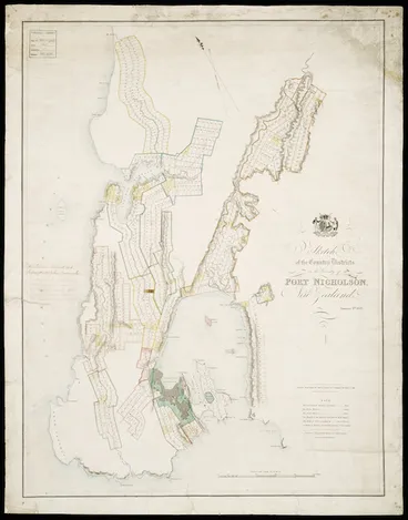
SP 10 Township of Featherston 1858 by W. R. Carver - Survey Office Plan 10587 Wellington District Office, Department of Lands and Survey - Maybe Archives NZ Ref: AAFV 997/133 WT24 (R22824390)
SP 11 (1871)
Surveyed by J. J. Dennan Dec 1870. Plan drawn by T. M. Grant 26 Feb 1878
National Library of New Zealand
SP 12 (1866)
Surveyed by J. T. Stewart, J. Thomson, J. Knowles and M. Carkeek
National Library of New Zealand
SP 13 (1878)
There is an earlier 1875 Plan by A. Dundas et al - Archives NZ Public Works Department Collection
Archives Central
SP 14 Township of Sanson 1872 by A. Dundas. Prepared as a Sale Plan for the Hutt Small Farms Association - Survey Office Plan 11014 - Maybe Archives NZ Ref: AAFV 997/133 WT25 (R22824391)
SP 15 (1874)
Surveyed by J. H. Jackson et al
National Library of New Zealand
SP 16 Plan of Marton 1876 by R. M. Skeet – Compiled from the official surveys as private Sale Plan - Alexander Turnbull Library - Maybe Archives NZ Ref: AAFV 997/133 WT29 (R22824395)
SP 17 Wairoa Township, Okotuku District 1868 by Octavius Carrington – prepared for the Colonial Defence Office – Head Office, Department of Lands and Survey (Statutory Branch Collection) - Maybe Archives NZ Ref: AAFV 997/133 WT13 (R22824377)
SP 18 Native Village at Wainui 1849 (just north of Porirua Harbour) by S. M. Scroggs – Head Office, Department of Lands and Survey (Statutory Branch Collection)
SP 19
Surveyed by W. M. Smith and S. C. Brees
National Library of New Zealand
SP 22 Working Settler Sections (25 acres) in the Wainuiomata Valley 1844 by H. S. Tiffen – A portion of plan showing the boundaries of the Port Nicholson purchase - Archives NZ Ref: AAFV 997/119 W4 (R22824216)
SP 23 Country Sections at Rangitikei 1850 by W. M. Smith - Survey Office Plan 10471 Archives NZ Ref: AFIH 22381 W5692/75 Roll Plan 547b (R22549242)
SP 24 Greytown Suburban Sections 1856 – Survey Office Plan 10551 - Archives NZ Ref: AFIH 22381 W5692/42 Roll Plan 357 (R22549076)
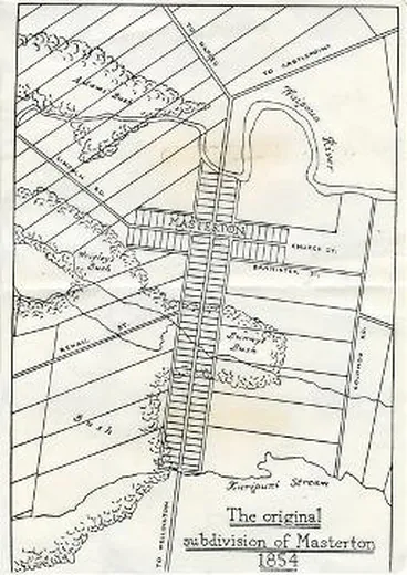
SP 25 Suburban Sections, Masterton 1855 - Survey Office Plan 10523 - Archives NZ Ref: AFIH 22381 W5692/105 Roll Plan 712d (R22549388)
SP 26 Rural Sections Taratahi Plain 1856 - Survey Office Plan 10551 - Archives NZ Ref: AFIH 22381 W5692/42 Roll Plan 357 (R22549076)
SP 27 Featherston Suburban Sections 1856 - Survey Office Plan 10558 - Archives NZ Ref: AFIH 22381 W5692/106 Roll Plan 713 (R22549397)
SP 28 Carterton Rural Sections 1858 – Head Office, Department of Lands and Survey (Statutory Branch Collection)
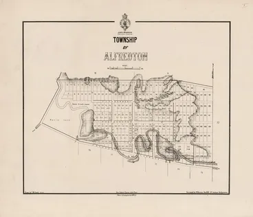
SP 29 Township of Alfredton and Moroa Rural Sections 1868 – Survey Office Plan 10873 - Department of Lands and Survey. Also Survey Plan of Moroa East Coast District 1867 - Archives NZ Ref: ACGT 18803 LS MISC/199/98 (R24729062)
SP 30 Sections in Small Farm Block, Rangitikei 1857 - Survey Office Plan 10573 – Department of Lands and Survey
SP 31 Sections in Pahautanui Agricultural Reserve 1858 - Survey Office Plan 10505 - Department of Lands and Survey
SP 32 Agricultural Reserve, Hutt District 1863 (Mungaroa Valley) – Survey Office Plan 10677 - Department of Lands and Survey
SP 33 Outline Plan of the Initial Three Manawatu Townships 1869 (Fitzherbert, Foxton, Palmerston) by J. T. Stewart et al – a portion of plan entitled “Sketch Map of Manawatu and Rangitikei-Manawatu Blocks" – Public Works Department, Archives NZ
SP 34 Sections in Township of Foxton and Motoa Block 1866 – Survey Office Plan 10800 - Archives NZ Ref: AFIH 22381 W5692/49 Roll Plan 392 (R22549057)
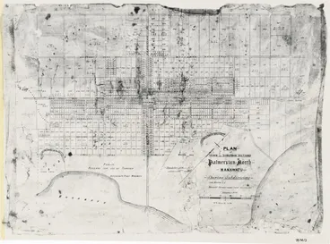
SP 35 Rural Sections in Township of Palmerston 1866 - Survey Office Plan 10769 - Archives NZ Ref: AFIH 22381 W5692/52 Roll Plan 414 (R22549129)
SP 36 Rural Sections in Township of Fitzherbert 1867- Survey Office Plan 10814 – Archives NZ Ref: AFIH 22381 W5692/45 Roll Plan 407 (R22549088)
SP 37 Sections in the Township of Palmerston to be thrown open for Selection on Deferred Payments 1872 - Alexander Turnbull Library MapColl-832.4396gbbd/1872/Acc.6058
SP 41 (1874)
National Library of New Zealand
SP 39 Sections in the Townships of Sandon and Carnarvon 1873 - Survey Office Plan 11069 - Department of Lands and Survey - Maybe Archives NZ Ref: AAFV 997/123 W53 (R22824257)
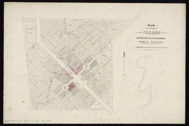
SP 40 Suburban Sections Town of Feilding, Manchester Block 1874 - Alexander Turnbull Library - Maybe Archives NZ Ref: AFIH 22381 W5692/50 Roll Plan 398 (R22549115)
SP 42 Scandinavian Settlement, Awapuni, Township of Palmerston 1871 - Survey Office Plan 10769 - Archives NZ Ref: AFIH 22381 W5692/52 Roll Plan 414 (R22549129)
SP 43 (1875)
Surveyed by A. W. Carkeek with A. Monro
National Library of New Zealand
SP 44 Scandinavian Settlement, Eketahuna (Mellemskov) 1875 - Archives NZ Ref: R22824280 (Record missing)
SP 45 Standard Plan of Okotuku District 1869 with later editions - Head Office, Department of Lands and Survey (Statutory Branch) - Try Archives NZ Ref: AAFV 997/136 W82 (R22824277 and R22824278)
SP 46 Wairarapa & East Coast Illegal Pastoral Occupations 1850. A specially drawn plan based on information from "The Land and the Squatter: Wairarapa 1843-1853: An essay in Human Ecolocy," M.A. Thesis Victoria University, Wellington (1962) by R. D. Hill and contemporary manuscript records - Patterson Thesis 1984
SP 47 Pastoral Occupations in the Wairarapa 1849 - Survey Office Plan 10468 - Archives NZ Ref: AFIH 22381 W5692/102 Roll Plan 709b (R22549372)
SP 48 Lower Wairarapa Occupations showing Homestead Purchases 1854 - Survey Office Plan 10482 - Archives NZ Ref: AFIH 22381 W5692/101 Roll Plan 709a (R22549367)
SP 49 Runs in the Wairarapa and East Coast Districts 1855 – Survey Office Plan 10535 - Archives NZ Ref: AFIH 22381 W5692/102 Roll Plan 710e (R22549371) and ACGO 8368 IA36/8/42 (R22420398). Also Alexander Turnbull Library MapColl-832.45gc/1855/Acc.4502.
SP 50 Preliminary sketch map of the Runs in the Rangitikei District 1855 - Archives NZ Ref: ADXS 19480 LS-W2/68 1856/210 (R20551750)
SP 51 James Coutts Crawford’s Watts Peninsula Pastoral Property – A specially drawn plan constructed from records in the Wellington Lands and Deeds Office - Patterson Thesis 1984
SP 52 Eastern Part of the Rangitikei District: Large holders of Compensation Land 1850 - Survey Office Plan 10469 - Archives NZ Ref: AFIH 22381 W5692/76 Roll Plan 547 (R22549254)
SP 53 Smaller Pastoral Holdings on the Taratahi Plain 1857 - Survey Office Plan 10557- Archives NZ Ref: AFIH 22381 W5692/105 Roll Plan 712b (R22549390)
SP 54 Smaller Pastoral Holdings on the Moroa Plain late 1850s - Survey Office Plan 10540 - Archives NZ ref: AFIH 22381 W5692/104 Roll Plan 712 (R22549380)
SP 55 Plan attached to application for Grazing Land submitted by F. J. Burton c1856. This is of a run in the Whareama district that was sold to Mr Vallance and draws attention to a disputed boundary - Archives NZ Ref: ADXS 19480 LS-W2/8 1859/343 (R24434000)
SP 56 Plan attached to application for Grazing Land in the East Coast district submitted by Job Wilton c1857 - Archives NZ Ref: ADXS 19480 LS-W2/5 1857/137 (R24433038)
SP 57 Sections on Edwin Meredith’s Run, Whareama River, East Coast District 1860 - Survey Office Plan 10627 - Department of Lands and Survey
SP 58 Cameron's Run, Pahaoa, East Coast District 1866 - Survey Office Plan 10779 - Department of Lands and Survey
SP 59 Five Shilling Land in the Districts of Rangitikei and Turakina 1866 - Survey Office Plan 10754 - Archives NZ Ref: AFIH 22381 W5692/123 Roll Plan 424 (R22549462)
SP 60 Building of Daniel Riddiford’s Te Awaite Station, East Coast District – Specially drawn plan constructed from “Crown Land Sales Returns” in Wellington Provincial Gazettes and records in the Wellington Lands and Deeds Office. Patterson Thesis 1984
SP 61 Parae Karetu Block 1874 - Archives NZ Ref: ACGT 18803 LS MISC/190 (R24729038)
![Township of Foxton / surveyed by J.T. Stewart ... [et al.] ; Henry Jackson chief surveyor 1866. Image: Township of Foxton / surveyed by J.T. Stewart ... [et al.] ; Henry Jackson chief surveyor 1866.](https://images.digitalnz.org/7oas6FjbJQQ4tVi42WoI6YkYSYs=/368x0/https%3A%2F%2Fndhadeliver.natlib.govt.nz%2FNLNZStreamGate%2Fget%3Fdps_pid%3DIE26833230)
![Plan of rural sections, Manchester Block, Manawatu District [electronic resource] ; Plan of suburban sections, town of Feilding, Manchester Block, Manawatu District / F. Gillett, surveyor. Image: Plan of rural sections, Manchester Block, Manawatu District [electronic resource] ; Plan of suburban sections, town of Feilding, Manchester Block, Manawatu District / F. Gillett, surveyor.](https://images.digitalnz.org/x4OcSILCAHXL609A2V6g-jHSmMk=/368x0/https%3A%2F%2Fndhadeliver.natlib.govt.nz%2FNLNZStreamGate%2Fget%3Fdps_pid%3DIE18813451)
