Ngauranga
A DigitalNZ Story by Ann Reweti
Ngāti Mutunga and Te Atiawa occupation of Ngauranga , early hotels, road access to Johnsonville, industries, Fort Kelburne, Māori Land March 1975.
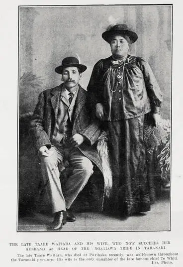
Pipitea Pā, Matiu Island, Wharekauri, Kaimātaotao Pā, Porirua Road, Ngahauranga Road, White Horse Hotel, Cobb & Co, Te Wharepouri, Mohi Ngaponga, Taare Waitara, Wi Tako, Mere Kapa Ngamai I, Wellington Meat Export Company, CMC Factory, Fort Kelburne
Māori history of Ngauranga Gorge
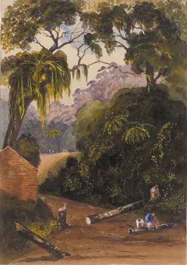
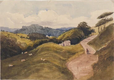
Ngauranga Road, Wellington.
Museum of New Zealand Te Papa Tongarewa
On the Nghauranga Road, Wellington.
University of Otago
During the time of Te Atiawa migrations to Te Whanganui-a-Tara, 1820s-1830s, the settlements at Ngauranga and Pipitea were held by (whanaunga) Ngāti Mutunga until Ngāti Mutunga departed to Wharekauri, 1835 -- It is said that they transferred their holdings to Te Atiawa as they sailed forth from Matiu.
Following this transfer of land, ownership of a crop of cultivated potatoes at Ngauranga led to a dispute in which Te Wharepouri supported an attack on Mohi Ngaponga. Mohi of Ngāti Haumia, a hapū of Taranaki, along with Te Retimana Pukahu of the Ngāti Tupaea hapū of Ngāti Ruanui had paddled from Te Aro in their waka to harvest the potatoes they had planted at Ngauranga. Te Wharepouri drove Mohi away but left Te Retimana unmolested.
At Ngauranga, Te Wharepouri, with others, built a whare, Te Akitiwha, for communal use, and later built a separate whare for himself, named Pukeatua. He was in Palliser Bay in 1836, and tried to capture the whaling ship Active, in order to sail to the the Chatham Islands. But the captain managed to secure Te Wharepouri, and 20 men, and dropped them at Queen Charlotte Sound.
Pipitea pā, 1842
Manatū Taonga, the Ministry for Culture and Heritage
Pearse, John, 1808-1882 :[Nelson district. 1851] Head of New Zealand canoe from the Gna Hauranga Pah
Alexander Turnbull Library
Oliver, Richard Aldworth, 1811-1889 :Emily - a Maori. Nauranga, Jany [18]51
Alexander Turnbull Library
Ngāti Mutunga abandoned their pā at Pipitea, and cultivations at Ngāuranga, in 1835, sailing on the ship the Rodney, to Wharekauri
Matiu, Wellington Harbour
Manatū Taonga, the Ministry for Culture and Heritage
Chatham Islands
Manatū Taonga, the Ministry for Culture and Heritage
Inns and dwelllings : the first tracks from Wellington to Porirua followed the hilltops from Ngaio to Johnsonville , then veered down through the valley past (present day) Churton Park and onwards to Tawa. In time a narrow track wound up Ngāuranga Gorge to Johnsonville and this opened up a need for two inns at Ngāuranga. In the late 1930s the torturous track was upgraded, leading to a later development of a fine highway and pass-over bridges as part of State Highways 1 & 2.
On the Porirua Road, near Crofton.
University of Otago
[Barraud, Charles Decimus], 1822-1897 :Ngahauranga Road. [1800s]
Alexander Turnbull Library
Ngahauranga Road, Wellington, N.Z.
Museum of New Zealand Te Papa Tongarewa
Wellington District — [Col. Mccleverty's Deed] — 4 Octr 1847
Victoria University of Wellington
Pearse, John, 1808-1882 :Nga Hauranga. Residence of the Chief E'Tako. [Between 1852 and 1856]
Alexander Turnbull Library
Some early Te Atiawa shareholders in the land: Rawiri Matangi, Manihera Te Toru, Hirini Nukutaia, Te Wharepōuri, Rawiri Motutere, Mere Ngamai, Taare Waitara.
John Pearse : Nga Hauranga : " A small European style cottage at Ngauranga Pa, with a canoe on stilts beside it and another canoe at the edge of the Ngauranga Stream in the foreground. Behind the house is the upright memorial canoe for Te Wharepōuri (built after his death in the 1842), with the hill beyond it. There is part of another canoe raised on supports next to the house. " -- https://natlib.govt.nz/records/22787612
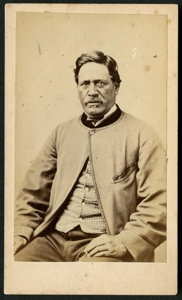
Richards, E S (Wellington) fl 1862-1873 :Portrait of Mohi Ngaponga
Alexander Turnbull Library
Taare Waitara and haka party, Parihaka, 1890s
Alexander Turnbull Library
Wi Tako
Manatū Taonga, the Ministry for Culture and Heritage
Maori woman, thought to be Mere Kapa Ngamai I, Ngati Te Whiti, Ngati Tawhirikura, Te Atiawa iwi. From the album: New Zealand and South Seas
Museum of New Zealand Te Papa Tongarewa
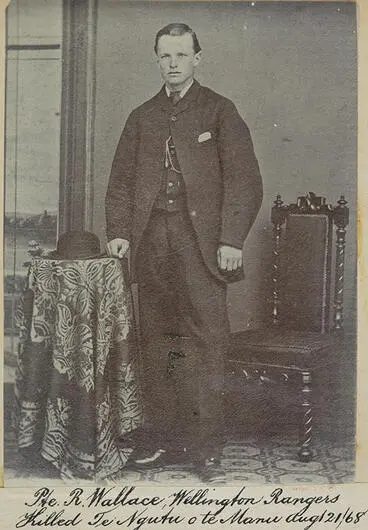
Arapera Rongouaroa, "Belle of Te Aro" and Taare Warahi were the children of Hemi Parae and Tawhirikura Karopihia of Te Aro Pā. Arapera married William Ellerslie Wallace who arrived at Te Whanganui-a-Tara on the Glenbervie, 1840. William was a shopkeeper, and for a short time joined the armed forces, but left abruptly following the death of his brother in the war. William acquired two hotels at Ngāuranga - the Ngauranga Inn and the Wallace (The White Horse) Hotel.
Rollason, James Bernard Richard Walter, 1856-1906: [Ngauranga, late 1840s]. [ca 1900]
Alexander Turnbull Library
Creator unknown: Photograph taken by James Bragge at Ngauranga, Wellington, with the White Horse Hotel
Alexander Turnbull Library
Cobb & Co coaches, Ngauranga Gorge, Wellington
Alexander Turnbull Library
Trooper William Wallace
Alexander Turnbull Library
Ngauranga, entrance to the gorge, Wellington N.Z. 27 February 1880
Museum of New Zealand Te Papa Tongarewa
Ngauranga Gorge
Museum of New Zealand Te Papa Tongarewa
Ngauranga Gorge Road to Porirua
Auckland Art Gallery Toi o Tāmaki
Ngauranga
Alexander Turnbull Library
Ngauranga Gorge in Wellington
Alexander Turnbull Library
Ngauranga Gorge in Wellington
Alexander Turnbull Library
Ngauranga nr Wellington NZ
Auckland War Memorial Museum Tāmaki Paenga Hira
Earthworks - changing the landscape of Ngauranga Gorge : 1920s-1940
Car on the Ngauranga Gorge road
Alexander Turnbull Library
Road construction, Ngauranga Gorge, Wellington
Alexander Turnbull Library
Excavators, bulldozers and trucks assembled at Ngauranga Gorge
Alexander Turnbull Library
An angledozer at work, Ngauranga - Photograph taken by John Dobree Pascoe
Alexander Turnbull Library
Road through Ngauranga Gorge
Alexander Turnbull Library
Construction of Ngauranga Gorge Road, Wellington - Photograph taken by J D Pascoe
Alexander Turnbull Library
The Highway
Car travelling up Ngauranga Gorge, Wellington - Photograph by John Dobree Pascoe
Alexander Turnbull Library
Motorway by Johnsonville at the top of Ngauranga gorge, Wellington
Alexander Turnbull Library
Construction of the Johnsonville Bypass, Ngauranga Gorge, Wellington
Alexander Turnbull Library
Industrial Ngauranga
OBITUARY. (Hawera & Normanby Star, 18 August 1924)
National Library of New Zealand
OBITUARY (Evening Post, 14 November 1938)
National Library of New Zealand
THE MUNICIPAL ABATTOIRS. (Manawatu Standard, 19 July 1901)
National Library of New Zealand
Municipal Abattoir, Ngauranga, Wellington
Alexander Turnbull Library
Machinery inside the Wellington Meat Export Company, Ngauranga Gorge
Alexander Turnbull Library
Fire at CMC factory, Ngauranga, Wellington
Alexander Turnbull Library
Two unidentified boys inside building, after an explosion at Ngauranga Gorge Road, Wellington
Alexander Turnbull Library
Ngauranga Gorge entrance with railway track
Alexander Turnbull Library
Ngauranga, Wellington
Alexander Turnbull Library
Fort Kelburne: https://natlib.govt.nz/records/40696030
Military fortification built between 1885 and 1887 at the base of Ngauranga Gorge, demolished in 1963 as part of the Wellington motorway development. Spelling varies but is likely named after Viscount Kelburne the eldest son of Lord Glasgow who was Governor-General of New Zealand 1892-1897.
Creator unknown :Photograph of Fort Kelburne at Ngauranga, Wellington, at start of demolition
Alexander Turnbull Library
Remains of No 2 gun lying near Ngauranga Gorge Road, Wellington, during the demolition of Fort Kelburne
Alexander Turnbull Library
Accidents in Nagauranga Gorge
Accident in Ngahauranga (Ngauranga) Gorge
Alexander Turnbull Library
Train crash at Ngahauranga (Ngauranga)
Alexander Turnbull Library
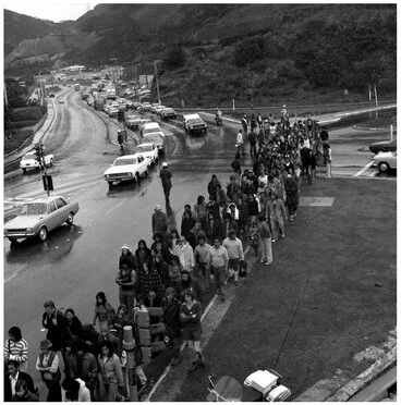
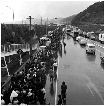
Māori Land March 1975 passes through Ngauranga
Māori Land March en route down Ngauranga Gorge to Parliament, 13 October 1975
Alexander Turnbull Library
Māori Land March - 13 October 1975, Ngauranga Gorge, Wellington
Manatū Taonga, the Ministry for Culture and Heritage
Māori Land March - 13 October 1975, Wellington
Manatū Taonga, the Ministry for Culture and Heritage


![Wellington District — [Col. Mccleverty's Deed] — 4 Octr 1847 Image: Wellington District — [Col. Mccleverty's Deed] — 4 Octr 1847](https://thumbnailer.digitalnz.org/?resize=770x&src=https%3A%2F%2Fndhadeliver.natlib.govt.nz%2Fwebarchive%2F20201108000000mp_%2Fhttp%3A%2F%2Fnzetc.victoria.ac.nz%2Fetexts%2FTur02Plan%2FTur02PlanP049a.jpg&resize=368%253E)
