Early days in Hillcrest, Hamilton
A DigitalNZ Story by Zokoroa
A pictorial history of the Hillcrest suburb in Hamilton from its militia settler farming years to becoming an educational hub with the Hamiton Teachers' College, University of Waikato and Ruakura Research Centre.
Hamilton, Hillcrest, Waikato, University of Waikato, Ruakura, Hamilton Teachers' College, farming, orchards, Land Wars, Tainui, Militia, Waikato Regiment
1. Hamilton's Hillcrest Suburb ON CREST OF A HILL
Hillcrest is a suburb in south-east Hamilton that stretches from the Waikato River and Hamilton Gardens through to the University of Waikato and Ruakura Research Centre. The land was originally owned by Waikato-Tainui until it was confiscated in 1864 after the New Zealand Wars with British troops. This story traces from when militia settlers farmed Hillcrest's slopes (formerly known as Steele's Hill), orchards were established and the Government set up the Ruakura No. 5 State Farm. Parts of Hillcrest {renamed in the 1940s) were given back to Tainui in 1995 in the Tainui Deed of Settlement. Nowadays Hillcrest is 'home' to thousands of University students and family homeowners.
Hillcrest (previously Steele's Hill)
Hillcrest suburb lies to the east of Hamilton's CBD and Waikato River.
Manatū Taonga, the Ministry for Culture and Heritage
Waikato University atop Hillcrest's western ridge
View of Waikato University atop the Hillcrest ridge and the Waikato River in the far distance.
Alexander Turnbull Library
Farmland subdivided over the years & housing & school built
Today Hillcrest is 'home' to family homeowners & students studying at the University & St John's College.
Alexander Turnbull Library
2. Icons on Hillcrest
The Cowshed
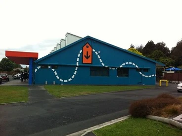
The Cowshed near Oranga was a former cowshed (!) built in 1953 on land previously part of Ruakura's No. 5 State Farm.
University of Waikato
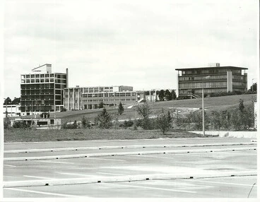
Hamilton Teachers' College (now part of University of Waikato)
View from the playing fields towards the Teachers' College & University Admin block on Hillcrest Road.
Archives New Zealand Te Rua Mahara o te Kāwanatanga
The Station
Hamilton Railway Station building was relocated to Hillcrest Rd in the 1960s & was a cafe & meeting hub for many years.
University of Waikato
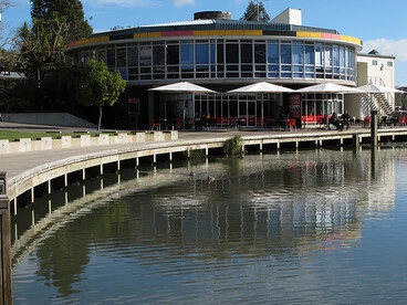
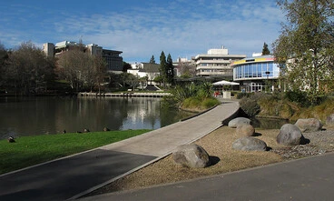
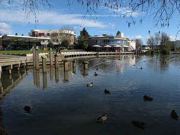
The University's lakes and Oranga
In 1970s-80s Bryant Hall & Student Village held tug-of-wars across Knighton Lake & dined in Oranga next to Oranga Lake.
Manatū Taonga, the Ministry for Culture and Heritage
3. Hillcrest's beginnings - confiscated Waikato-Tainui land
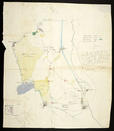
Kirikiriroa (Hamilton) was one of several Ngāti Wairere settlements along the Waikato River. They had developed the Kirikiriria Pā between London Street and Bryce Street. Early settlers also called the surrounding area Kirikiriroa. During the Waikato Land War, Ngāti Wairere abandoned the Pā before the arrival of British troops and relocated to Hukanui (Gordonton) where they are today. Under Governor Grey's New Zealand Settlements Act 1863, large areas of Waikato-Tainui land (1.2 million acres) were confiscated by the Crown in 1864.
Kirikiriroa (Hamilton) was owned by Waikato-Tainui until it was confiscated in 1864 following the New Zealand Wars.
Confiscated territory after the Maori Wars, in the Waikato, 1864
Archives New Zealand Te Rua Mahara o te Kāwanatanga
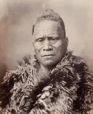
King Tāwhiao went into exile (1864-1881) into the King Country & Ngāti Wairere went to Hukanui (Gordonton).
King Tawhiao
Auckland Art Gallery Toi o Tāmaki
4. Militia settlers recruited for 4th Waikato Regiment
The Government decided that the settlement of the confiscated Waikato-Tainui land would be by free land grants to militia men who would be able to defend it in case of future hostilities. Lieutenant William Steele was sent to Sydney to enlist men for the 4th Battalion of the Waikato Regiment who were required to serve for three years. Their settlement at Kirikiriroa was renamed "Hamilton" by Colonel William Moule in honour of Captain John Fane Hamilton, Commander of H.M.S Esk, who was killed in Battle of Gate Pā, Tauranga.
Lt Steele sent to Sydney at end of 1863 to recruit militia settlers & was promoted to Captain after his return in March.
Photograph – Captain William Steele
Waikato Museum Te Whare Taonga o Waikato
Kirikiriroa was chosen as a settlement for the 4th Battalion of the Waikato Regiment and their families.
Hamilton West
Manatū Taonga, the Ministry for Culture and Heritage
Kirikiriroa renamed by Col. William Moule after Capt. John Fane Hamilton who was killed in Battle of Gate Pā, Tauranga.
Captain Hamilton
Alexander Turnbull Library
5. MILITIA SETTLERS ARRIVE IN HAMILTON, 1864
The 4th Battalion of the Waikato Regiment arrived on 25 August 1864 on the vessel ‘Rangiriri.
Steele & 4th Regiment of Waikato militia (119 men & families) landed at Memorial Park in Hamilton East on 24 Aug 1864.
Gunboat 'Rangiriri'...1864
Auckland Libraries
4th Waikato Regiment. From left: Chas Ramsay, Dr A.A. Brewis, W.H. Hume, Lt Shilson
4th Waikato Regiment
University of Waikato
6. MILITIA SETTLERS RECEIVE FREE LAND GRANT
The township of Hamilton East was first surveyed by William Australia Graham in 1864. A map showing land grants can be viewed on History of the University of Waikato Campus, p.2 (pdf). A 'corridor' of land was set aside for a proposed tramway which did not eventuate and became Ruakura Road and Silverdale Road. A Gazette notice of 3 August 1863 had set out the terms under which grants of land were made to settlers: the militiaman had to be “not above 40 years of age, have to be able to produce certificates of good character, good health, and general fitness for service as required”. The terms of enlistment in the Waikato Regiment stated: "free grants of land were to be made on the scale of 400 acres for each field officer, 300 acres for each captain, 250 acres for the surgeon, 200 acres for each subaltern, 80 acres for sergeants, 60 acres for corporals, while each private was to be allocated 50 acres. In addition, each man was to be allocated a town section and 1,000 feet of timber to build a house. For the first year, until they received their land, they were to receive rations."
4th Waikato Regiment
Hamilton City Libraries
7. Town sections developed
Military outposts were built on both sides of the Waikato river, now the sites of St Peter's Cathedral and the Hamilton East end of Anzac Parade. Within a year there were huts and stores around the redoubts and a ferry service connected both settlements. In December 1877, the towns of Hamilton West and Hamilton East were merged to form the Borough of Hamilton. The first traffic bridge between Hamilton West and Hamilton East, known as the Union Bridge, opened in 1879. Three remaining buildings of that time - Beale Cottage, Nickisson House and Masonic Centre - are located in Hamilton East.
Artist John Philemon Backhouse's pencil & watercolour image of a military settler’s cottage in Hamilton.
Settler’s cottage, Hamilton
Manatū Taonga, the Ministry for Culture and Heritage
8. Farms & Orchards developed at Steele's Hill (HILLCREST)
The Hillcrest area was initially known as Steele's Hill which was named after Captain William Steele whose land grant was on its western slopes. Later Steele's Hill was renamed Hillcrest in the 1940s when the Borough of Hamilton became a city. In his history of Hamilton Astride the river (1977), P.J. Gibbons writes, "... within the projected township and beyond were clumps of forest, very wet underfoot, dominated by tall kahikatea pine... There were considerable areas of fern and manuka scrub.. Beside the terraces deep wide gullies marked the immediate landscape, the clearer places were bogs and swamps. The climate was mild and pleasant by day and cold by night." Whereas some settlers farmed their land, many did not finding it too swampy and either abandoned or sold it after the required three years of military service were completed.
NORTHERN slopes of HILLCREST - RUAKURA AREA:
Blocks of land were granted on the northern slopes of Hillcrest-Ruakura to Ensign John Crawford, Ensign Rivers and J.C. Pearson. All three sold their land to Yorkshire settler Isaac Coates who had arrived in Hamilton in 1868. From 1878-1892, Coates was involved in local politics and a range of businesses, including flaxmilling, land drainage and operating mowing machines, reaper and binders and threshing machines (see NZETC: Cyclopedia of New Zealand).
Ensign John Crawford sold his land (Lot 237-41) to Isaac Coates
Crawford allowed Lt Johnstone to graze his stock on his land; then sold his block of land to Coates.
Alexander Turnbull Library
J.C. Pearson (Lot 242) & Ensign Rivers (Lot 243) sold their land grants to Coates
Coate's leased his 690 acres to brother-in-law Thomas Dinsdale in 1872 who worked it for five years to sow wheat & oats.
Manatū Taonga, the Ministry for Culture and Heritage
Coates became Councillor and Mayor
Elected to Hamilton Borough Council (1878, 1887-88, 1901-02, 1905-07) and served two terms as Mayor from 1888-92.
Victoria University of Wellington
The Government also acquired acres in 1886 and additional land in 1901, including Coates' farm at Ruakura, with the intent of setting up a training and research centre under the Waikato Agricultural College Model Farm Act (1888). (See AgResearch: Ruakura Campus)
Government acquired 137 acres (1886), plus Coates' farm & other land (1901)
The Waikato Agricultural College Model Farm Act (1888) paved the way for an experimental & research centre.
Manatū Taonga, the Ministry for Culture and Heritage
Ruakura Experimental Station established by Government on 914 acres
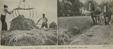
Ruakura's initial experiments were on using superphosphate as a top-dressing for hay,
Alexander Turnbull Library
Ruakura State Farm opened with cadets (1912)
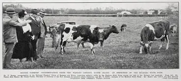
By 1946 Ruakura carried 2,000 sheep, 400 dairy cattle, 100 beef cattle, and 200 pigs.
University of Waikato
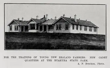
In 1920 the “Homestead” was built by Auckland architect W A Cumming to accommodate cadets
For The Training Of Young New Zealand Farmers
Auckland Libraries
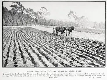
Early ploughing on the Ruakura state farm
Auckland Libraries
For an audio account of growing up in Hamilton as a teen during the 1930s-40s and studying a farming course at Ruakura, see interview, "Teenagers at Woodlands in the 1930s and 1940s: an interview with Jack Riddell and Margaret Harris" held in Hamilton City Libraries Heritage Collections.
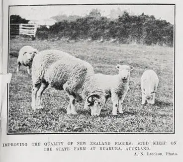
Improving The Quality Of New Zealand Flocks
Auckland Libraries
Plough team Ruakura Government Farm.
Auckland War Memorial Museum Tāmaki Paenga Hira
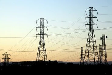
From 1922-1968, part of Ruakura was used to establish the Hamilton substation and switchyards for the supply of electric power from the Waikato River hydro schemes.
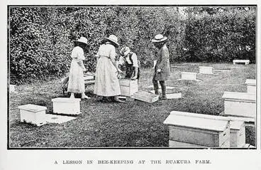
A lesson in bee-keeping at the Ruakura farm
Auckland Libraries
Ruakura Research Station, Hamilton, Waikato Region
Alexander Turnbull Library
From 1922-1968, Hamilton substation & switchyards set up for supplying electric power from Waikato River Hydro schemes.
Visual Pollution ~ Wires over Hamilton
Manatū Taonga, the Ministry for Culture and Heritage
Ruakura Agricultural Research Centre, ca. 1984
Hamilton City Libraries
Eastern Slopes of Hillcrest area:
Farming:
Land was granted on the eastern slopes to Captain William Steele and the area became known as Steele's Hill (renamed Hillcrest in the 1940s). Later in 1899, Steele's land was sold to Yorkshire farmer Isaac Coates who had already begun purchasing land from other militia settlers. Coates had been Mayor of Hamilton from Jan 1888 - Oct 1889 and Dec 1889 - Dec 1892. After selling his land, Steele was a land agent and valuer, and served on Waikato County Council and many local organisations. Sydney Park in Hamilton East was renamed Steele Park after Steele's death.
Captain William Steele received a town acre & 300 acres (Lots 232-235)
Alexander Turnbull Library
Area named Steele's Hill after William Steele
Steele employed labourers to clear the land & by May 1866 had ploughed & sown 100 acres.
Alexander Turnbull Library
Yorkshire settler & former Hamilton Mayor Isaac Coates purchased Steele's land in 1889
With financial losses over Waikato Land Association's scheme to drain Piako swamp, Steele sold up to Isaac Coates.
Hamilton City Libraries
Sunnyside (McMiken) Orchard:
The block of land granted to W. Powell on the corner of Hillcrest and Silverdale Roads was purchased by farmer Frank Clifton Litchfield. In 1910, Litchfield's property was sub-divided and sold in separate lots to farmers, including the McMiken family (Lot 6) who established an orchard. Further land was purchased by McMiken in 1925 (part of Lot 5) and 1943 (Lot 9). Access to the Orchard's homestead was off Silverdale Road which was originally named Knighton Avenue in 1943. It was changed by the Hamilton City Council in 1962 who named it after Silverdale Farms, owned by Captain C.A. Davis.
W. Powell granted land (Lot 236) on cnr of Hillcrest & Silverdale Rds and sold it to Frank Clifton Litchfield
Powell did not take up his land grant which became part of Frank Clifton Litchfield's property.
Alexander Turnbull Library
John McMiken bought 14 bare acres (Lot 6) from Litchfield (Aug 1914)
McMiken gave 10 acres to his son Jeff (June 1916) - a 16 yr old cadet at Ruakura Institute of Farm Instructors.
Alexander Turnbull Library
Sunnyside Orchard (top left) established by Jeff McMiken
Orchard expanded in 1925 (part of Lot 5) & 1943 (Lot 9).
University of Waikato
Over the years, a variety of apples and pears were grown, according to adverts in the Waikato Times (1925), which won prizes at several Waikato Winter Shows. In 1958 all of the Sunnyside Orchard's land was transferred to W.J. McMiken Ltd. In 1962, a satellite orchard was set up on 20 acres in Newstead and fruit trucked to McMiken Orchard. (See Eureka Express, July 2014 and History of the University of Waikato Campus, p.9)
Variety of apples & pears grown which won prizes at Waikato Winter Shows
Auckland War Memorial Museum Tāmaki Paenga Hira
Sunnyside Orchard (bottom right) next to housing on east side of Hillcrest Rd
Entrance to the Orchard's homestead was off Silverdale Road (formerly called Knighton Avenue).
Alexander Turnbull Library
Orchard becomes part of University of Waikato:
In 1979, McMiken's Orchard was acquired under the Public Works Act for the University of Waikato. Part of the land was leased back to the Orchard over the following decade. In 1991, Sunnyside Orchard moved to Newstead and was known as J.W. McMiken & Co. The University removed the grove of apple trees behind a privet hedge that bordered Hillcrest Road and the public walkway to Scotland Place which lies next to Gate 7 (see Campus map). The Waikato Management School and carparks were built, followed by the Faculty of Law building.
Part of Orchard on Hillcrest Road opposite University's Gates 5-8
(Bottom right)
Hamilton City Libraries
Another view of part of Orchard on Hillcrest Road
(At middle bottom of photo)
University of Waikato
Privet hedge surrounded Orchard on Hillcrest Road
Privet hedge surrounded the grove of apple trees on Hillcrest Road and the public walkway to Scotland Place (by Gate 7).
University of Waikato
Nowadays - Management & Law buildings occupy Orchard site near Hillcrest Road
The buildings are on the former grove of fruit trees which had a privet hedge.
University of Waikato
Other facilities were also established off the Silverdale Road entrance to the former orchard - University student accommodation at Orchard Park and the Silverdale Road Apartments, TKKM o Toku Mapihi Maurea, Te Kōhanga Reo o Ngā Kuaka, NIWA, Landcare Research, Aquatic Research Centre, Huataki Waiora School of Health, and carparks. See Campus map.
Orchard Park student accommodation on former Sunnyside Orchard site
University of Waikato
Western slopes of HILLCREST - KNIGHTON - claudelands:
Grants of land to militia on Hillcrest's western slopes between the Hamilton East Town belt, Ruakura and Hillcrest Road changed ownership over the years. The history of the land now occupied by the University of Waikato Campus can be traced through a series of plans held by Land Information New Zealand (LINZ). Research was carried out by Evelyn Stokes, Professor of Geography, which was completed by Max Oulton, the University of Waikato cartographer. Copies of the plans are held in the New Zealand Collection of the University of Waikato Library. (Source: History of the University of Waikato Campus (July 2017) compiled by John Robson.)
Farming:
Joseph Mullins grew potatoes on his block of land (Lot 224) which was between the Timber Reserve in Claudelands and Peacocke's farm. Peacocke sold his land to Samuel Seddon who named his 350 acre farm 'Knighton Farm'. Seddon had arrived from Howick in 1869 & bred prize-winning shorthorn herd & Lincoln sheep.Army doctor William Raynor’s land (Lots 229-231) was located between the Hamilton East town belt and Hillcrest.
Peacocke's farm (Lots 225-228) included land now occupied by the University on northside near Ruakura
Lieutenant John Peacocke was granted 250 acres from the Hamilton East town belt to Ruakura.
Alexander Turnbull Library
Raynor's land sold to neighbour Peacocke & town acre gifted to Methodists
Raynor’s land lay between Peacocke's farm and Cambridge Road. He focused on his medical practice rather than on farming.
Alexander Turnbull Library
Farmland on western slopes subdivided in 1900s:
In the 1900s the land on the western slopes of Hillcrest was surveyed and subdivided. By 1901 there were two main owners - the Ruakura State Farm and the land lying to the west of Hillcrest Road which was owned by Auckland solicitor Edward Robert Nolan Russell. During 1906-7, the Russell property was purchased by various people for residential sections and to lease to farmers. Lots 15-17 and 19-24 were bought by Joseph Croke Darby who also acquired the northern part of Lot 18 in 1922. Darby was a Roman Catholic Priest and leased his land to farmers.
Farmland on western slopes subdivided in 1900s & ownership changed
Alexander Turnbull Library
Hospital proposed in 1940s:
In July 1941 the property owned by Darby was transferred to the Public Trustee and in May 1947 transferred to the Waikato Hospital Board. In November 1949, the southern half pf Lot 18, which had successive owners, was acquired by the Crown. (See History of the Waikato Campus, pp. 7, 8). However, the proposed chest hospital was not built as the decline in tuberculosis cases had reduced demand for the hospital.
No.5 Dairy Farm & Cowshed established in 1950s:
During the 1950s, the "No 5 Dairy Farm" was established on the Hospital Board Land by the Ruakura Research Station.
No.5 Dairy Farm & iconic Cowshed (built 1953)
During 1950s Ruakura's No. 5 Dairy Farm was sited on Waikato Hospital Board land.
University of Waikato
Present-day: Housing & University Campus & St. John's College:
Nowadays some of this land on the western slopes of Hillcrest forms the Knighton Road / Old Farm Road / Ruakura Road area, part housing, part University campus, and the St. John's College whose front entrance is off Hillcrest Road. A new road was constructed in 1930 which was named Knighton Road in 1947 by the Hamilton City Council. The University moved to the site in 1964 after the land was made available to the University and Hamilton Teachers' College under the Public Works Act 1962.
Knighton Road
A new road was constructed in 1930 and named "Knighton Road" in 1947 by Hamilton City Council.
Hamilton City Libraries
Southern slopes of Hillcrest - Waikato River:
Farming:
Highlander Captain James McPherson farmed his allotted land along the eastern slopes to the banks of the Waikato River from Riverlea to the Hamilton Gardens near Cobham Bridge. The homestead is featured in a Waikato Times article: Memory box: Riverlea. McPherson also set up a flax-dressing mill on Manaonua Stream, near Tamahere. He became involved in local and national politics - Kirikiriroa Highway Board Secretary (1868), first Member of Parliament for Waikato (1871), and Clerk and Treasurer to the newly-established Waikato County Council (1876-1905).
Captain James McPherson farmed his land & named his property Riverlea
Riverlea Road named c1910-1920 & became part of Hamilton boundary in 1961/2
Alexander Turnbull Library
Bretton Orchard:
Bretton Orchard was established on Hillcrest's southern slopes along the Cambridge Road which adjoined the Hamilton Borough Boundary. The original homestead was built in 1869. According to Waikato Times adverts the orchard grew a variety of apples including Jonathan, Pearmain, Delicious and Winesaps. The orchard was advertised for sale in 1919 - it had been subdivided into sections of 2.5 to 14 acres in size and there were c3000 fruit trees. (see Papers Past: Waikato Times). Bretton Orchard's "7-roomed house, implements and sundries" were offered for sale by Mr W.F. Sinclair in 1922 (see Papers Past; Waikato Times). Bretton Terrace was named in 1950 after Bretton Orchard by then owners J.P. Flynn and R.A. Forster who also named Flynn Road in 1940.
9. HILLCREST ROAD WAS NAMED IN 1904
The road running atop the crest of Steele's Hill was named Hillcrest Road by the Waikato County Council in 1904.
(For a list of all the street names in the Hillcrest suburb, including year named, if named by owner and named after, see: Wikipedia: List of street names in Hamilton, Waikato - Hillcrest )
Hillcrest Road - looking south from Gate 5. (Dec 1965)
Installing power poles along Hillcrest Rd which runs atop the crest from Hillcrest shops to the University
University of Waikato
10. STEELE'S HILL RENAMED HILLCREST in 1940s
As Hamilton's population increased and its boundaries extended, the Waikato County Council renamed Steele's Hill as Hillcrest in the 1940s. Today, the Hillcrest suburb spans both sides of the hill with views overlooking the Hamilton City basin on one side and farmland stretching to the Kaimai Range and Mt. Te Aroha on the other. The hill's slopes are gentle rising as can seen from these photographs of the western slope looking up towards the University Science block and the eastern slope looking up to the School of Management building. The Hillcrest roundabout at the southern end near Hillcrest Normal School provides the gateway into Hamilton from Cambridge (State Highway 1) and Morrinville (State Highway 26) and further afield.
View from central Hamilton looking towards Hamilton East and Hillcrest, with Kaimai Range in the distance.
Central Hamilton, Waikato Region, including Hamilton Courthouse and Waikato River
Alexander Turnbull Library
Hillcrest's western slope
View from Chapel Lake on western slope of Hillcrest hill towards University Science Block.
University of Waikato
Hillcrest's eastern slope
View of School of Management looking up from the lower carpark, which was part of the former Sunnyside Orchard.
University of Waikato
11. HAMILTON CITY (1945) & HILLCREST A NEW SUBURB (1949)
At first the growth in population in Hamilton was slow with only about 250 people by 1868. The numbers increased to more than 2100 by 1906, with a further 800 people living outside the boundary in Claudelands and Frankton. The borough of Hamilton continued to expand, taking in Claudelands in 1912 and amalgamating with Frankton in 1917. The 1945 census showed Hamilton’s population reached 22,000, enabling the borough to become a city. The city’s boundaries expanded with the development of new suburbs including Hillcrest (1949), Enderley, Beerescourt and Melville. (See Hamilton New Zealand)
Audio recordings on living and/or working in Hillcrest
For a trip down memory lane, hear former residents and workers in the Hillcrest area being interviewed about their lives in the 1930s, 40s and 50s as part of the Hamilton City Libraries' Oral History project in 1996-1997.
See webpage.: https://hamiltonlibraries.co.nz/heritage/archives/oral-history The audio recordings are included on its Heritage Collections webpage.
Oral interviews with former Hillcrest residents are held in Hamilton City Libraries Heritage Collections
(Image: For memories of the Knighton area when at primary school during World War II, listen to Lester Bowler's story.)
Hamilton City Libraries
12. Stores & Homes
On 29 November 1961, Abel’s Supermarket opened in Hillcrest - it was one of New Zealand’s earliest supermarkets, and Hamilton’s first. Wynn Abel (1911-1995) was a Tamahere resident from 1968 to 1989, owning with wife Jean, Malabar Farm on Airport Rd. They bred thoroughbred racehorses, including Van der Hum who won the Melbourne Cup in 1976. (See Tamahere Forum.)
Hillcrest Motors near State Highway 1 southern roundabout near Hillcrest Normal School (1950s).
Hillcrest Motors
Hamilton City Libraries
Hillcrest Motors & Abel's Supermarket (1960s).
Hillcrest Motors and Abel's supermarket
Hamilton City Libraries
Abel's Supermarket( (1961) at State Highway 1 southern roundabout near Hillcrest Normal School.
Erwin Leonard Guy Abel with his son Len in Abel's Supermarket, Hillcrest, Hamilton
Alexander Turnbull Library
Naylor Street Auto Services at corner of Dey Street (now Wairere Drive) (1984).
Naylor St Auto Services Ltd
Hamilton City Libraries
Michael W. Tuck Motors was located next to shops on Masters Avenue.
Michael W. Tuck Motors
Hamilton City Libraries
Hillcrest Library (2011) at Masters Avenue (relocated from former remodelled house next to Hillcrest shops).
HillcrestLibrary
Aotearoa People's Network Kaharoa
Hillcrest Tavern "The Hilly" was on corner of Clyde & York St near Knighton Rd. Popular watering hole for Univ students!
The Hillcrest Tavern (Various events)
Hamilton City Libraries
At Hillcrest home (Hamilton)
Museum of New Zealand Te Papa Tongarewa
House, Hillcrest; Hamilton
Museum of New Zealand Te Papa Tongarewa
13. Schools
Hillcrest School: 1923 -
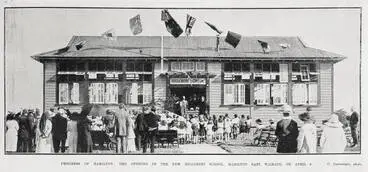
Hillcrest School (now Hillcrest Normal School) was officially opened on 4 April 1923 with two classrooms and a headmaster’s room.
Hillcrest school
Hamilton City Libraries
Hillcrest School - opening baths 1926
Hamilton City Libraries
Hillcrest School Jubilee
Hamilton City Libraries
Hillcrest School Jubilee
Hamilton City Libraries
Hillcrest High School: 1972 -
Hillcrest High School opened in January 1972.
Hillcrest High School
Hamilton City Libraries
ST JOHN'S COLLEGE: 1962-
When the Russell property west of Hillcrest Road was subdivided in 1906-7, Lots 13-14 were acquired by farmer James Moroney. Later in September 1919, Moroney transferred this land to The Institute de Notre Dame des Missions Trust Board, who transferred it to the Roman Catholic Bishop of the Diocese of Auckland in 1960. A Roman Catholic boys' secondary school, St. John's College, was built and opened in 1962. The College had initially opened at Marist School (now Marian Catholic School) in 1961 and transferred to its new site in October the following year. See aerial flyover of present-day buildings and grounds.
Catholic Diocese acquire land
Farmer James Moroney sold his land to The Institute de Notre Dame des Missions Trust Board in 1919.
Wikipedia
St. John's College built 1961
The College initally opened at Marist School (now Marion Catholic School) in 1961 & shifted in Oct 1962.
Alexander Turnbull Library
14. Hamilton Teachers' College - WaikAto school of education
The Hamilton Teachers' College was first located in Melville at what is now Melville High School; then moved to its current Hillcrest site in 1964. The College merged with the University of Waikato in 1991, to become New Zealand’s first fully professional School of Education.
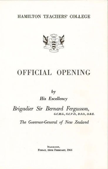
Opening of Hamilton Teachers' College (1965)
Archives New Zealand Te Rua Mahara o te Kāwanatanga
The Sports Centre and Teachers' College
University of Waikato
A view past Teachers' College
University of Waikato
The Swimming Pool under construction
University of Waikato
The Teachers' College swimming pool
University of Waikato
Aerial view of northern end of Hillcrest Road at intersection with Silverdale Road.
Looking south along Hillcrest Road, 1979
University of Waikato
15. University of Waikato takes shape
In 1964 the University of Waikato was officially opened and shaped development of the area over the next decades. The Ministry of Works, led by Assistant Government Architect J.R. Blake-Kelly, laid out a masterplan in which the academic buildings stood on the high ground, halls of residence on the low ground on the opposite side of the campus, with student facilities located between them. As the University grew so did the need for student accommodation. Infill housing and student accommodation blocks began to overtake the acre sections that were a character of Hillcrest. (See University of Waikato: History)
Model of projected campus
University of Waikato
Growth of Faculties and buildings:
1964: Initially, the University comprised the School of Humanities and a School of Social Sciences
1969: School of Science (now the Faculty of Science and Engineering) was established
1972: Centre for Māori Studies and Research was set up in the School of Social Sciences
1972: School of Management Studies
1973: Computer Science and Computing Services (which became the Faculty of Computing and Mathematical Sciences)
1987: Te Kohinga Mārama Marae opened as part of the College of Education
1991: Law School officially opened on 3 May (now Te Piringa - Faculty of Law sited in a new building since 2016 at Gate 7)
1991: School of Education which became Te Kura Toi Tangata Faculty of Education
1992: New School of Management Studies building (MSB) opened
1996: Four-storey extension to the MSB building opened
1996: School of Māori and Pacific Development was established (now Te Pua Wānanga ki te Ao - Faculty of Māori and Indigenous Studies)
1998: School of Management Studies (MBS) officially changes its name to the Waikato Management School (WMS)
1999: Schools of Humanities and Social Sciences were merged to form the School (later Faculty) of Arts and Social Sciences
2001: Gallagher Academy of Performing Arts built alongside Knighton Lake
2010: The tertiary partnership was widened to include Te Whare Wānanga o Awanuiārangi in the Eastern Bay of Plenty
2011: Te Kotahi Research Institute
2016: Te Piringa - Faculty of Law sited in new Law and Management building at Gate 7. The extension includes a new ‘glass box’ entrance for the Waikato Management School (WMS), a Management Student Centre (MSC), Executive Education teaching spaces, and computer labs. The extension between the existing Management building and the new Law building is one storey underground of which the roof is covered in grass to create a lawn garden.
2019: University of Waikato opens its $50 million new Tauranga campus, offering the Bachelor of Business and Waikato MBA
2019: Demolition of the former Law School building and W block and the gutting of A block
2020: Six murals were painted on buildings during a week-long Boon on Campus: A street art festival at the University
2022: Waikato Management School's front entrance on Hillcrest Road has a mural painted by Miriama Grace-Smith, from the Boon on Campus collective.
-
2023: The Pā officially opened in July to provide the new main entrance to the campus: Ko Te Tangata: The University Wharenui (ceremonial meeting house), Vice-Chancellor & Faculty offices, The Canopy (staff club, staff club, café and bar), Te Āhurutanga: The Student Hub (including food outlets and social learning spaces), Te Kōpūroa (2 multi-function teaching rooms and commercial kitchen), and Te Pua Wānanga ki te Ao — Faculty of Māori and Indigenous Studies. The Pā has since won awards at the 2024 New Zealand Architecture Awards, the 2024 Property Industry Awards, and the Resene Colour Award at the 2024 New Zealand Institute of Architects Waikato and Bay of Plenty Architecture Awards. See: https://www.waikato.ac.nz/about/the-pa/
See current list of divisions, faculties and schools:The University of Waikato: About us and the Campus map.
University Campus, 1965
University of Waikato
University buildings: University of Waikato campus, 1969
Manatū Taonga, the Ministry for Culture and Heritage
Aerial view looking east, 1988
University of Waikato
For a snapshot history of the design of each Campus building, see The University of Waikato 1964-2014.
John Robson summarises through maps and photographs the development of the Campus buildings & grounds.
History of the University of Waikato Campus
University of Waikato
Teachers' College and A Block
University of Waikato
A Block on the hill, 1965
University of Waikato
Temporary Buildings arriving
University of Waikato
A Block and TB1. 1966
University of Waikato
University gates, 1967
University of Waikato
The Student Union Building under construction
University of Waikato
C Block under construction
University of Waikato
ITS Building, 1971
University of Waikato
ITS Building, 1972
University of Waikato
Gate 1 Carpark, 1979
University of Waikato
F, E, D and C Blocks
University of Waikato
Temporary Management Studies Buildings
University of Waikato
G Block under construction, 1988
University of Waikato
G Block
University of Waikato
Chapel Lake with I Block under construction
University of Waikato
J Block and K Block under construction
University of Waikato
Te Kohinga Mārama Marae was opened in 1987
The Meeting House is Te Ao Hurihuri and the Dining Hall is Te Otinga. Access is via Gate 4 off Hillcrest Road.
Manatū Taonga, the Ministry for Culture and Heritage
THE ICONIC COWSHED:
The Cowshed was originally built in 1953 on Ruakura's No. 5 Dairy Farm. Over the years it once housed the Waikato Students' Union administration, the president's office, NEXUS and Radio Contact 89FM (the transmitter was set up on the top of the Library).
Cowshed in the Waikato University Campus Photos 1960s
University of Waikato
Feb 1967: Renovated Cowshed on University grounds.
The Cowshed to McMeekan's orchard
University of Waikato
THE STATION:
The Station on Hillcrest Road is the former main railway station built in 1879. The building was relocated from Victoria Street after 1967 when the Hamilton Central underground train station was built. Vice-Chancellor Don Llewellyn initially planned to use it as a temporary Student Union building; then it was set up as the Common Room for staff. It became known for a number of years as the Station Café and Bar which was used by staff and students.
Disused Hamilton station building before it was shifted from Victoria St to the University
Hamilton Railway Station
Hamilton City Libraries
The building was derelict shortly after the railway was lowered and a new underground station was built
Hamilton railway station
Hamilton City Libraries
Student accommodation:
Bryant Hall built on Knighton Road
In 1970 the University leased about 3 acres to D.V. Bryant Trust to build two 3-storey buildings and a chaplain's house.
Victoria University of Wellington
Bryant Hall (on left) & Student Village (right) with Cowshed & Oranga in foreground
Students had their meals at Oranga. Later on catering facilities established at Bryant Hall & Student Village.
University of Waikato
Drawing of projected Student Village
University of Waikato
Student Village roof under construction
University of Waikato
Student Village opening in 1968
University of Waikato
Student Village with students
University of Waikato
Student Village and lake, 1969
University of Waikato
Student Village, 1977
University of Waikato
A student's room in 1989
University of Waikato
Orchard Park & Silverdale Road Apartments
Accommodation built on former Sunnyside (McMiken) Orchard on Silverdale Road
University of Waikato
The University Library:
Jenny King was appointed the University's first librarian in 1967.
Recently completed A Block, 1964
University of Waikato
A Block Stairwell. 1966
University of Waikato
The Library in A Block
University of Waikato
The Library, 1971
University of Waikato
Transferring the Library in 1976
University of Waikato
The Library, 1979
University of Waikato
The Library being extended
University of Waikato
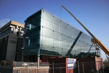
Library's new east wing
East wing - 28 August 2009
Manatū Taonga, the Ministry for Culture and Heritage
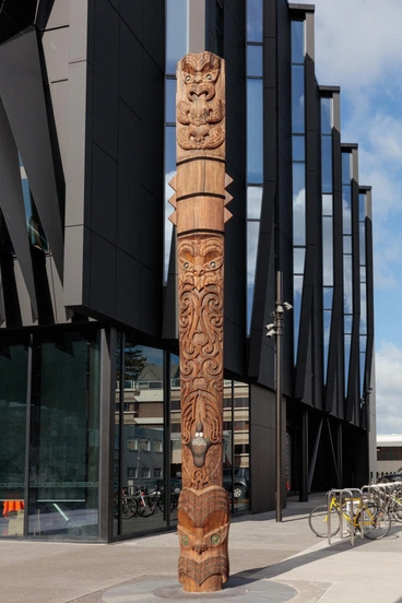
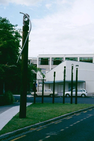
Pouwhenua | Whare Thompson
University of Waikato
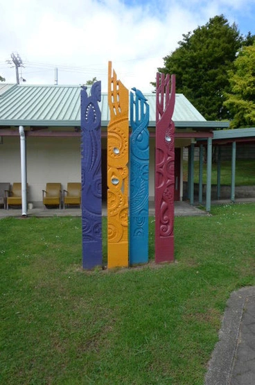
Te Puna Wai Mātauranga is the whakairo (carving) at the main entrance to the University of Waikato Library.
Tāwhaki
Manatū Taonga, the Ministry for Culture and Heritage
University lakes - Knighton, Oranga & Chapel Lakes
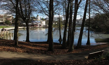
The Campus Lakes Knighton, Oranga and Chapel were formed to help drain the wet, swampy land the Unversity was sited on.
Knighton and Oranga Lakes, 1969
University of Waikato
Oranga Lake filling up
University of Waikato
Student walking past Oranga Lake
University of Waikato
Waikato University, open-air rock concert, Hamilton, 1971.
Alexander Turnbull Library
Early views of the Lakes
University of Waikato
Chapel Lake taking shape, 1972
University of Waikato
Lady Goodfellow Chapel
University of Waikato
I, J and K Blocks across Chapel Lake
University of Waikato
Waikato University Campus, Hamilton, NZ
Manatū Taonga, the Ministry for Culture and Heritage
Looking towards the University Library
Manatū Taonga, the Ministry for Culture and Heritage
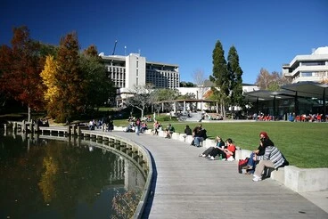
View from University lake towards the Admin block atop the western slope.
Waikato University Campus, Hamilton, NZ
Manatū Taonga, the Ministry for Culture and Heritage
Waikato University Campus, Hamilton, NZ
Manatū Taonga, the Ministry for Culture and Heritage
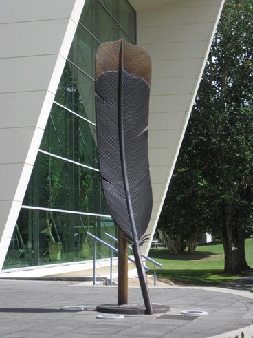
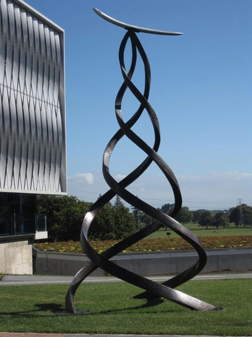
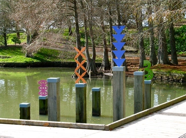
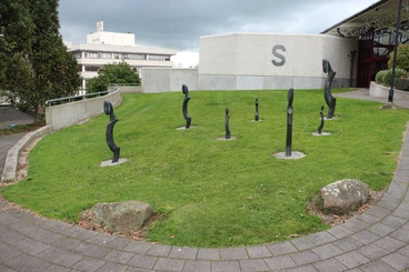
Ngā Tohu Mārama / Symbols of Understanding | Jeremy Shirley
University of Waikato
Academy of Performing Arts
Manatū Taonga, the Ministry for Culture and Heritage
Campus grounds and walkways:
Campus grounds, 1977
University of Waikato
Students walking past Oranga Lake
University of Waikato
Students walking through Campus
University of Waikato
Lamp posts on campus
University of Waikato
1976: View looking over Silverdale Road towards Waikato University
Aerial of Hamilton
Hamilton City Libraries
Waikato University campus pathway
Manatū Taonga, the Ministry for Culture and Heritage
Aerial view looking south, 1988
University of Waikato
Waikato University Campus, Hamilton, NZ
Manatū Taonga, the Ministry for Culture and Heritage
Exotic trees
Manatū Taonga, the Ministry for Culture and Heritage
Rugby on the University fields
University of Waikato
Koanga | Eugene Kara
University of Waikato
Pou Powhiri | Donn Ratana
University of Waikato
Unu | Jo'el Komene
University of Waikato
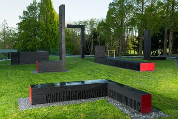
L Blocks | Sophie Hermann
University of Waikato
Montage of views near Oranga Lake
University of Waikato
Staff and students:
University of Waikato officially opened on 26 Feb 1965 by the Governor-General Brigadier Sir Bernard Fergusson
University of Waikato
Hamilton City Libraries
University of Waikato's official opening, 1965
University of Waikato
Professorial Board, 1965
University of Waikato
Dame Evelyn Stokes joined the Dept of Geography in 1964 as a lecturer and later was appointed as Professor until 2005
Dame Evelyn Stokes
Tauranga City Libraries
Michael Selby began as junior lecturer in Earth Sciences in 1964 & ended as a Deputy Vice Chancellor
In memoriam Michael J. Selby (1936-2018)
University of Waikato
Professors Jane & James Ritchie: Dpt. of Psychology
Jane and James Ritchie
Manatū Taonga, the Ministry for Culture and Heritage
Lecture in progress in the 1960s
University of Waikato
First Graduation Ceremony, 1967
University of Waikato
First Graduation Ceremony - Waikato University
University of Waikato
French tutorial in the late 1960s
University of Waikato
A tutorial taking place
University of Waikato
Programming the first computer, 1969
University of Waikato
A student occupation
University of Waikato
Waikato Students' Union newsletter 'Nexus' on services, clubs, events, 1968 -
Nexus [electronic resource].
National Library of New Zealand
16. Waikato-Tainui regain land (1995)
Waikato-Tainui settled grievances with the Crown with the 1995 Waikato-Tainui Raupatu Claims Settlement Act.
The Māori Queen, Dame Te Atairangikaahu, and her husband Whatumoana Paki witness the signing
Alexander Turnbull Library
Ruakura Superhub with inland port being developed in stages
When Tainui Group Holdings proposed building an inland port, the heritage values of Ruakura – land, buildings and trees – were raised with the Hamilton City Council as part of the 2015 submission process to the Ruakura Variation - Plan Change 1. The history of the land to be developed is included in the following report prepared in by Wiremu Puke for NaMTOK Consultancy Ltd: An assessment of the potential impact that any expansion and development of the Ruakura Estate might have on cultural values and manawhenua; A report prepared for Tainui Group Holdings Limited & Chedworth Park Ltd by NaMTOK Consultancy Ltd, Nov 2011.
The Ruakura Superhub opened in August 2023 and work is being completed in stages for industrial, commercial and residential development. The Ruakura Inland Port is located within the Superhub and lies adjacent to the East Coast Main Trunk rail line and the Waikato Expressway; thus at the nexus of the triangle of Tauranga, Auckland and Hamilton. The Ruakura Inland Port is to be managed by the Port of Tauranga through its subsidiary Quality Marshalling.
Find out more: Tainui Group Holdings: Ruakura Superhub and Ruakura Inland Port.
In 2017, development of Ruakura Superhub with inland port facilities began & first stage officially opened in Aug 2023
Work is being done in stages to develop a logistics freight hub & industrial, commercial & residential development
Radio New Zealand
Ruakura Superhub: Building Aotearoa's largest inland port
Radio New Zealand
Kmart distribution centre opens at NZ's biggest inland port
Radio New Zealand
Freightways to build $40m cold store facility in Hamilton
Radio New Zealand
17. Got some photos of Hillcrest, Ruakura & University of Waikato to share?!
You can upload your own images to stories you create in DigitalNZ. For more information, visit DigitalNZ's How to upload your own images to stories and Contributed Content Terms of use.
>>>>>>>>>>>>>>>>>>>>>>>>>>>>>>>>>>>>>>>>>>>
Further information:
History of the University of Waikato Campus (pdf) (July 2017) compiled by John Robson
Gibbons, P.J. (1977). Astride the river: a history of Hamilton. (Christchurch : Whitcoulls for the Hamilton City Council)
Norris, H.C.M. (1956). Armed settlers: The story of the founding of Hamilton, 1864-1874. (Hamilton: Paul's Book Arcade)
Stokes, Evelyn. History of the Land (Appendix C, pp. 274-300) In Day, Paul (1984). From the ground up: An informal chronicle of the genesis and development of the University of Waikato, 1964-1984 (University of Waikato)
Tainui Group Holdings, URL: https://www.tgh.co.nz/
(This DigitalNZ story was compiled in 2019 and updated in March 2025)



![Plan of oak trees planted in Sydney Square [ Steele Park ] in Hamilton East Image: Plan of oak trees planted in Sydney Square [ Steele Park ] in Hamilton East](https://thumbnailer.digitalnz.org/?resize=770x&src=https%3A%2F%2Fheritage.hamiltonlibraries.co.nz%2Frecords%2Fimages%2Flarge%2F20906%2Ff4280cf7d765265563b82d7b3e9df74fc60c0b4b.jpg&resize=368%253E)


